01

Oct

High-Rise Development Plan 2021: Three High-Rise Clusters for Frankfurt

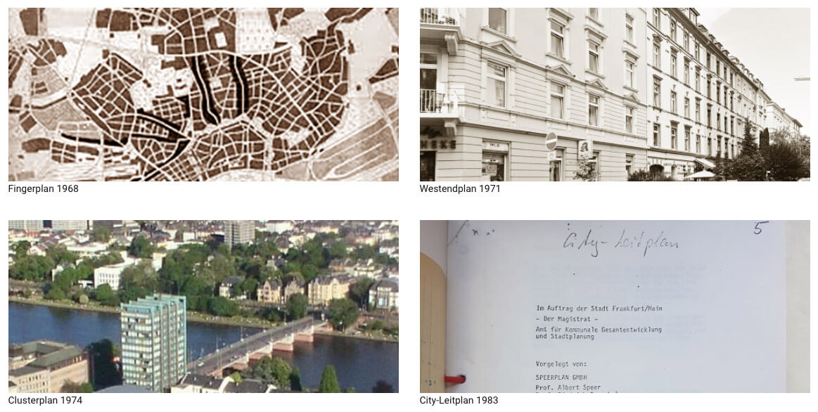
For many decades, a number of urban master plans have defined where tall buildings can be built in Frankfurt. Since 1998, the city has been trying to group high-rise buildings into defined clusters instead of letting them spread uncontrolled across the city. The result is today's dense Frankfurt skyline. In the last twenty years or

Prof. Dr. Stefan Pützenbacher

Prof. Dr. Stefan Pützenbacher, Expert in Planning LawThe Frankfurt high-rise master plan, often also referred to as the skyscraper master plan, is a so-called urban development model within the meaning of Section 1 (6) No. 11 BauGB in Germany. As a planning guideline, it specifies the general objectives of urban land use planning. The high-rise

Interview with Prof. Jochem Jourdan

Home > Magazin > Interviews > Prof. Jochem Jourdan Urban Developments in Frankfurt: Between Past and Future Interview with Architect and Urban Planner Prof. Jochem Jourdan A city like Frankfurt doesn't develop in a random way. The major urban development projects in Germany, such as the development of the European District, are subject to master

What is a high-rise plan?

Large cities use so-called development plans for better urban planning. Generally speaking, a development plan is an informal planning instrument in Germany to sound out development potentials in a city or in a district and to outline the prospects for its future use. It is not legally binding and is not subject to any standardized

01

Jun

Comment on the High-Rise Master Plan 2021

Experts see the high-rise master plan as a double-edged sword: the idea of ​​high-rise limitations is fundamentally welcome, for example to protect certain residential areas, but the implementation has not yet been stringent. The problem is that certain locations are cemented for decades and can bypass the requirements. In the last 10 years, many unimaginative

Master Plans

A master plan is an informal planning tool to explore development potentials in a city or district, to present a rough outline for its potential future use. It is not legally binding, and is subject to a standardised procedure. The planning scale is arranged between the regional land-use plans and local development planning, and is